


 Close Menu
 World
World
 Biography
 Health
 Education
 Business
 Lifestyle
 Sports
 Technology
 Animals
 History
 Food
Food
 Religious
 Startups
 Movies
 Politics
 Fashion
 Covid
Covid
 Diet
Diet
 Fitness
 Marketing
 Travel
 Science
 Reviews
 Social media
 Stories
 Facts
Facts
 Art
Art
 Entertainment
Kajal Singh

Technology
Distance Measuring Equipment Is Quietly Becoming Aviation's GNSS Backup
 Kajal Singh
Distance Measuring Equipment Is Quietly Becoming Aviation's GNSS Backup
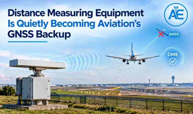
An aircraft on final approach must know how far it is from a fixed point of reference. GNSS normally provides that information, but GNSS signals can be degraded, unavailable or subject to interference, so navigation planning has to take that into account. Distance Measuring Equipment (DME) can provide independent slant range distance information from a ground station and is a useful part of a navigation architecture that does not rely solely on GNSS. For aviation projects comparing a DME antenna exporter India, antenna selection also needs to consider coverage, radiation pattern, frequency range and installation requirements. DME is not a like for like replacement for GNSS. It provides a separate source of distance information that can complement other navigation systems.
What DME Actually Provides
DME is a two part system of an airborne unit and a ground station. The interrogator of the aircraft sends a signal to the ground station, to which the latter replies and the airborne equipment calculates the distance from the time of the round trip. This distance is the slant range, the straight line distance from aircraft to station, not the horizontal ground distance and the difference increases as the aircraft approaches the station or flies higher.
Since this measurement requires a clean signal path in both directions, the distance measuring equipment antenna at the ground station must provide consistent gain and pattern over its coverage volume. For teams evaluating a DME antenna exporter India, these factors are important when selecting an antenna for a specific site. A weak or badly sited antenna can limit the ability of aircraft to range reliably against that station.
Why DME Matters When GNSS Is Not Available
In general navigation planners prefer sources that do not share the same signal chain. DME does not rely on a satellite based architecture like GNSS, so the same interference or availability issues do not affect its ranging accuracy. This makes it a valuable addition to a navigation architecture, rather than a stand alone alternative. DME is a backup to other aids and an aid to traditional navigation. It does not replace GNSS positioning, but provides distance information.
What Makes a Good DME Antenna
Antenna selection is not solely the choice of the highest available gain. A High Gain DME Antenna still must weigh several factors:
- Frequency range to meet the DME channel plan
- Capacity appropriate to the volume of business required
- output for coverage not only shaped radiation pattern
- Polarization suitable for installation
- Power handling for long term operation of ground stations
- Site elevation and local soil conditions
- Installation environment and structure of installation
- DME Coverage and Airport Planning
These factors must be considered together, because simply increasing gain without checking the pattern and the coverage volume can leave weak spots inside the desired service area.
How DME Works Alongside ILS
Usable DME coverage is generally line of sight dependent and therefore varies with antenna height, aircraft altitude, terrain and propagation conditions, along with system power and the service volume the installation is designed for. No standard coverage radius is used across installations. Coverage Evaluation. Each site needs to be evaluated for coverage based on the terrain in the vicinity and the operational requirement it is to satisfy.
How DME Works with ILS DME and ILS Antenna systems do different jobs. ILS uses its localizer and slateral and vertical guidance to the aircraft to the runway. DME however tells the aircraft how far it is from a reference point. Where an operational design is required to provide distance information in conjunction with an ILS approach, DME can be co located with the installation but not all ILS installations require it. The two systems are not interchangeable, they are complementary.
Why Antenna Experts?
Antenna Experts, based in New Delhi, India, has more than 35 years of experience in antenna design. Ground station antennas for navigation aids demand consistent frequency range, radiation pattern, gain and mounting accuracy and in house design, manufacturing and testing keeps those requirements aligned to the actual installation. Antenna Experts is an ISO 9001:2015, ISO 14001:2015 and ISO 45001:2018 certified company and NATO NCAGE registered, having supplied and installed products in over 60 countries, thus becoming a trusted DME antenna exporter India teams can count on for their site specific needs.
FAQs
1. Can DME back up GNSS navigation?
DME can provide independent distance information from ground stations and support navigation when GNSS is degraded or unavailable, but it is not a complete one for one replacement for GNSS positioning.
2. What band does a DME antenna operate on?
DME operates in the 960 to 1215 MHz band. This band is used for the interrogation and reply signals that result in a range measurement, with both ground station and airborne equipment operating in this band.
3. What DME antenna gain is needed?
There isn't one gain value in every installation. The required gain depends on coverage, site geometry, system power, antenna pattern, aircraft altitude and the specific service requirement.
4. How is DME co located with ILS?
DME may be co located with or associated with an ILS facility when the operational design requires distance information in conjunction with approach guidance. ILS and DME are different kinds of navigation.
Source:
Click for the: Full Story
You might like